Core Platform
PlanSuite brings together property information, planning controls, mapping and AI-assisted planning intelligence for the Victorian planning system. The core platform is available to councils and planning consultants alike.
Purpose-built interactive mapping for the Victorian planning system.
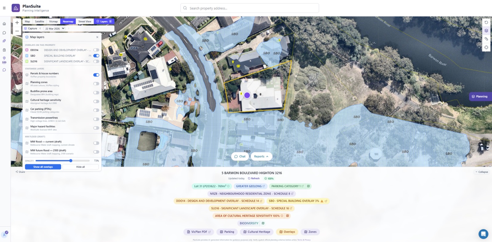
PlanSuite Maps brings together the planning and property information planners regularly need to understand and assess a site. Rather than moving between multiple mapping systems, websites and planning documents, planners work from one place to quickly understand the key planning characteristics affecting a property.
Depending on the property and location, PlanSuite Maps can help you access and understand:
Planning zones
Planning overlays
Zone and overlay schedules
Precincts and incorporated planning information
Car parking categories
Melbourne Water future flood mapping
State Heritage Register information
Precinct Structure Plans and growth area information
Bushfire information
Cultural heritage information
Future Homes eligibility
Property boundaries and parcel information
Relevant planning controls applying to the selected property
Ask Victorian planning questions in plain English.
PlanSuite Chat is an AI-assisted planning intelligence tool designed specifically for the Victorian planning system. Ask a question and get a structured response based on the relevant planning scheme provisions, legislation and planning information. Responses identify and reference the relevant provisions, so users can review the underlying requirements and apply their own professional judgement.
PlanSuite Chat can assist with questions relating to:
Planning zones and overlays
Planning permit requirements
Planning scheme interpretation
Particular Provisions and General Provisions
Residential development and Clause 55 requirements
Car parking requirements
Planning processes and application assessment
Property-specific planning questions
Planning terminology and statutory requirements
At the counter and on the phone
For councils, PlanSuite Chat is particularly useful for planning counter and telephone enquiries. Officers can research and respond to a wide range of town planning questions while the customer is still on the line.
Rather than manually searching through planning schemes, legislation and supporting information during an enquiry, officers ask PlanSuite Chat the question and use the response as an immediate starting point.
Written advice instead? The Planning Advice Letter is built for formal written requests for preliminary planning advice. PlanSuite Chat is the faster, more flexible tool for live enquiries.
Current and historical aerial imagery inside the property workspace.
View current and historical aerial imagery alongside planning controls and property information without moving between separate systems. Historical imagery is particularly valuable where planners need to understand when development, vegetation removal, changes to access or other site alterations may have occurred.
Nearmap Integration can assist with:
Understanding existing site conditions
Reviewing development on the land
Understanding surrounding development
Reviewing changes to a property over time
Preliminary planning assessments
Planning application assessments
Compliance and enforcement investigations
Understanding built form, vegetation, access and surrounding land uses
Where a council or organisation maintains a Nearmap subscription, PlanSuite can integrate the service directly into the PlanSuite workflow.
Property, parcel and title information in one place.
PlanSuite gives planners a central location to identify and obtain the property and land information they need before starting an assessment. PlanSuite has partnered with LandServ to provide integrated access to land title information, so users can search for title information directly from the property workspace and, where required, download a recent land title for a fee.
Information available through PlanSuite may include:
Certificate of Title information
Title particulars
Property and parcel details
Registered land area
Lot and plan information
Parish information
Crown land information
Relevant LASSI property information
Property boundaries
Land identification information
Obtaining a recent title inside PlanSuite also helps users confirm that the title being relied on for an assessment is sufficiently current.
The core platform is the starting point. Councils and consultants each get purpose-built workflows on top of it.
